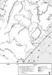
I had a hard time finding
maps of the off road trails on the east coast. It was even harder
finding anything high resolution and accurate. So the point of
this section is to be a high-resolution digital map database (at least
for trails within about 4 hours of the Baltimore area). For your convenience, I have
converted them all into JPG or GIF files for use in overlaying.
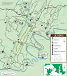
Below is a screen shot of Pennsylvania from Google Earth with a few of
my map overlays turned on.
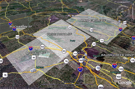
Click on the thumbnail
maps below for the full
size version. Save the picture to your computer and then use the image overlay
feature on Google Earth to position the maps. With some
patience, you can eventually align the maps into the correct
place. Use alignment cues from roads in the corners of the maps;
once you align the corners the centers will line up.
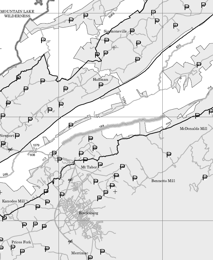
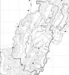
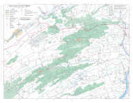
George Washington National
Forest, VA
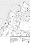
See the following link for
complete maps of the GWNF: http://www.fs.fed.us/r8/gwj/maps_brochures/mvum.shtml
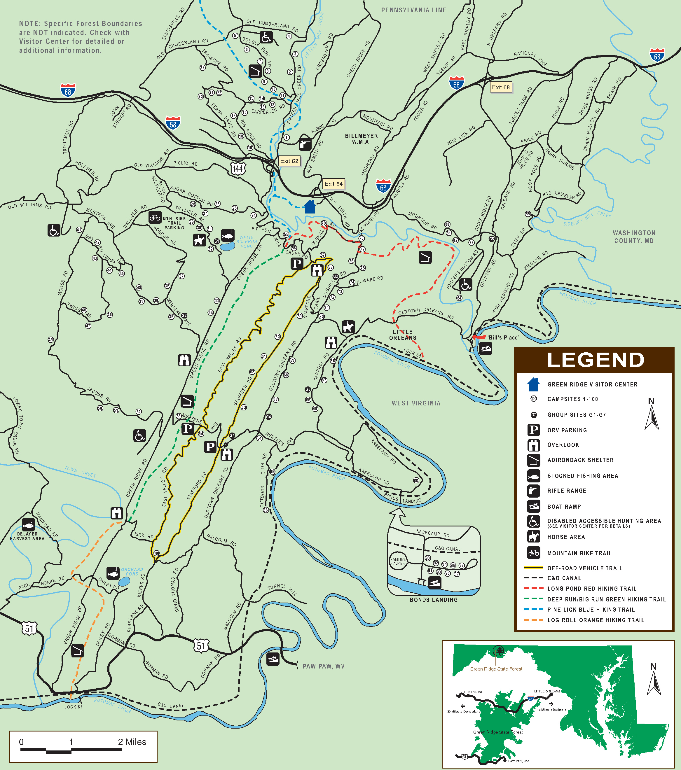
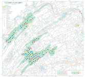
Green Ridge State Forest,
MD
The following trail report
helped me plan my first trip to Green Ridge. I was unsure what to
expect and their report gave me the confidence to go for it: http://www.core4x4.org/index.php?name=News&file=article&sid=89
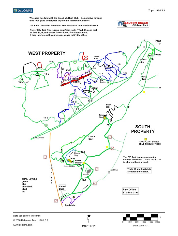
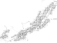
Raush Creek ORV Park, PA
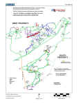
|
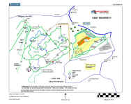
|
| West |
East |
Raush Creek is a
pay-to-play, privately owned park. http://www.rauschcreekoffroadpark.org/
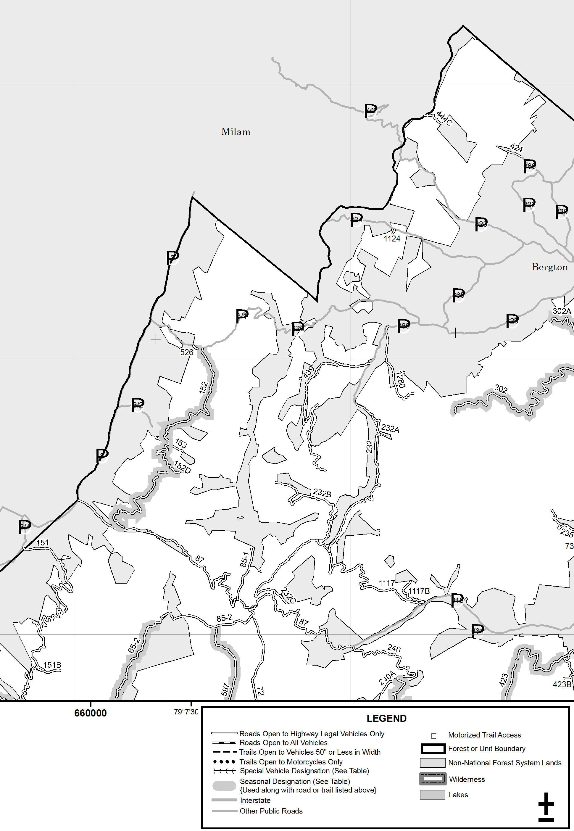
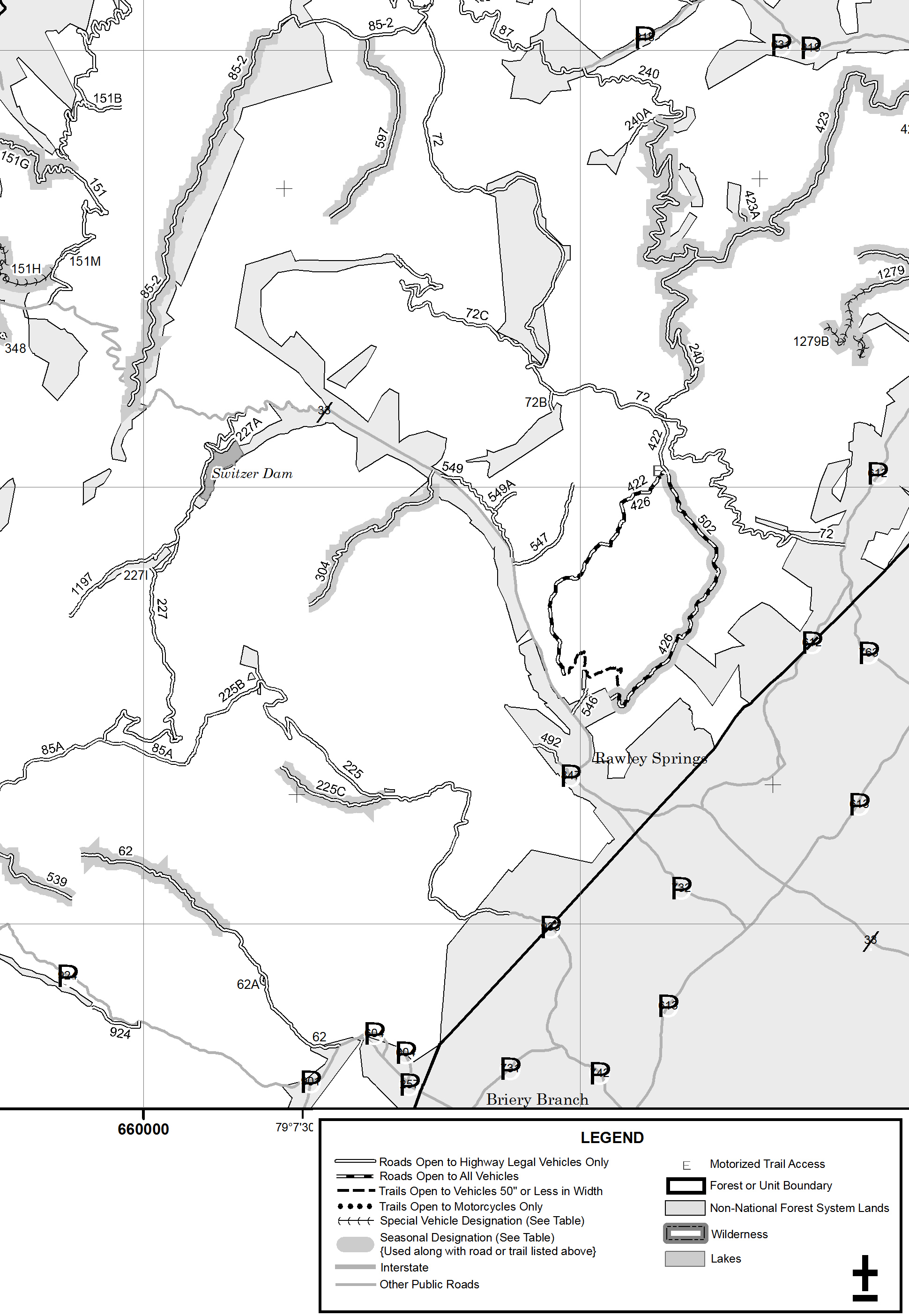
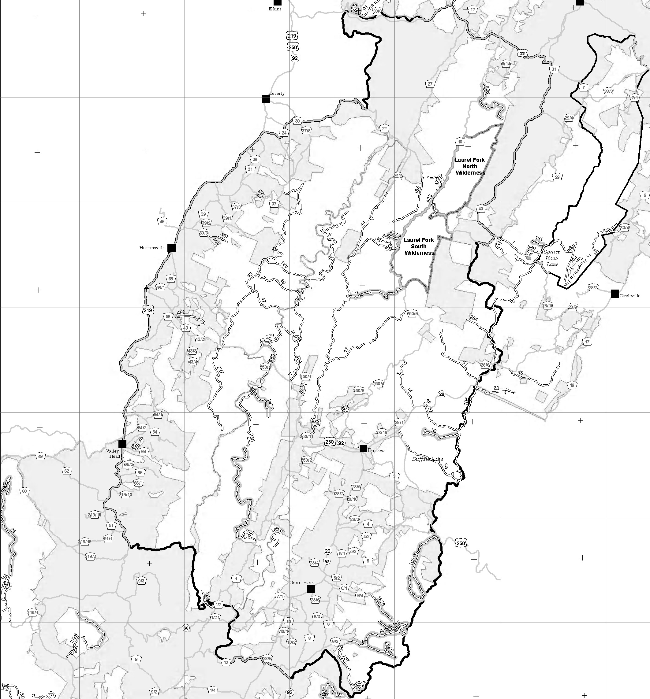
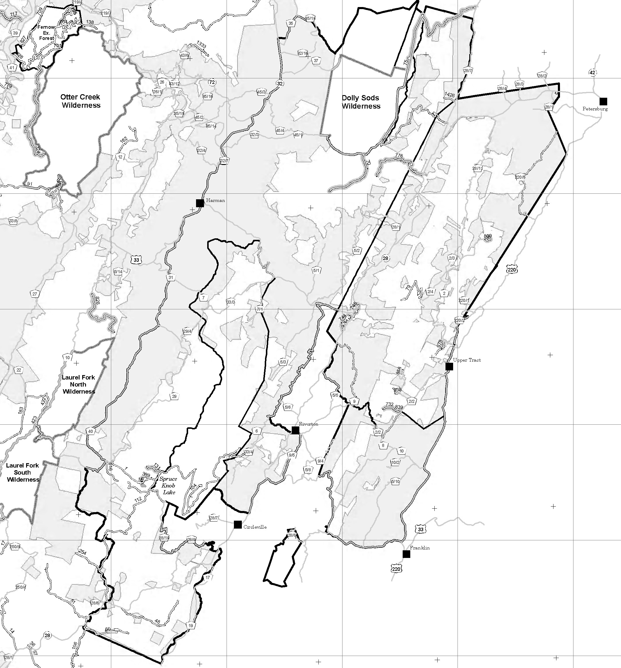
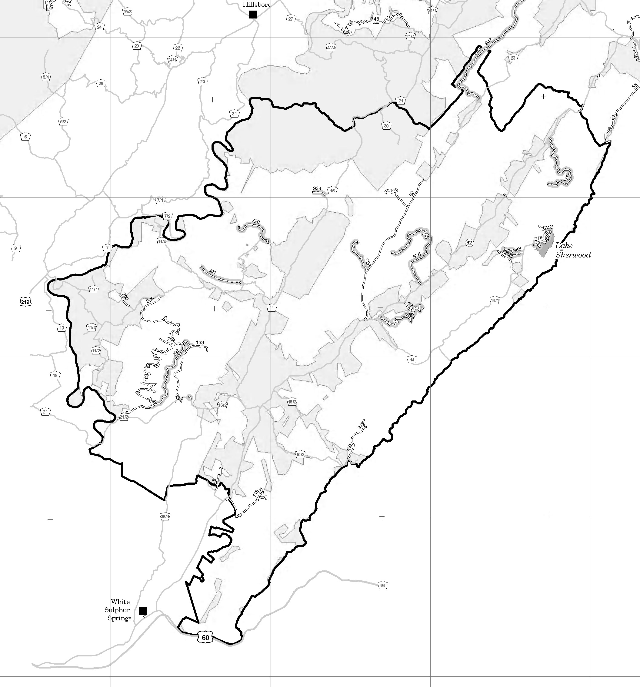
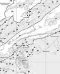
Monongahla National
Forest, WV
 |
 |
 |
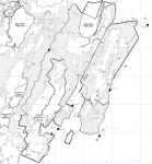 |
 |
| Cheat District |
Greenbrier District |
Marlinton District |
Patomac District |
White Sulphur District |
The above maps are taken
from the following link: http://www.fs.fed.us/r9/mnf/rec/snowmobile_policy.html
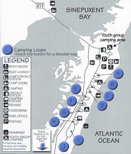
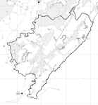
Assateague Island
National Seashore, MD VA
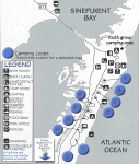
There is an annual
membership fee to drive on the beach trails. For more information about
over-sand vehicle use: http://www.nps.gov/asis/planyourvisit/osv.htm
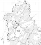
Bald Eagle State Forest,
PA
This file is LARGE.
You will want to right click and 'Save Target (or Link) As' or you
will get errors.
Resource for PA State
Forest Maps: http://www.dcnr.state.pa.us/forestry/stateforests/index.aspx
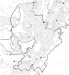
Tuscarora State Forest,
PA
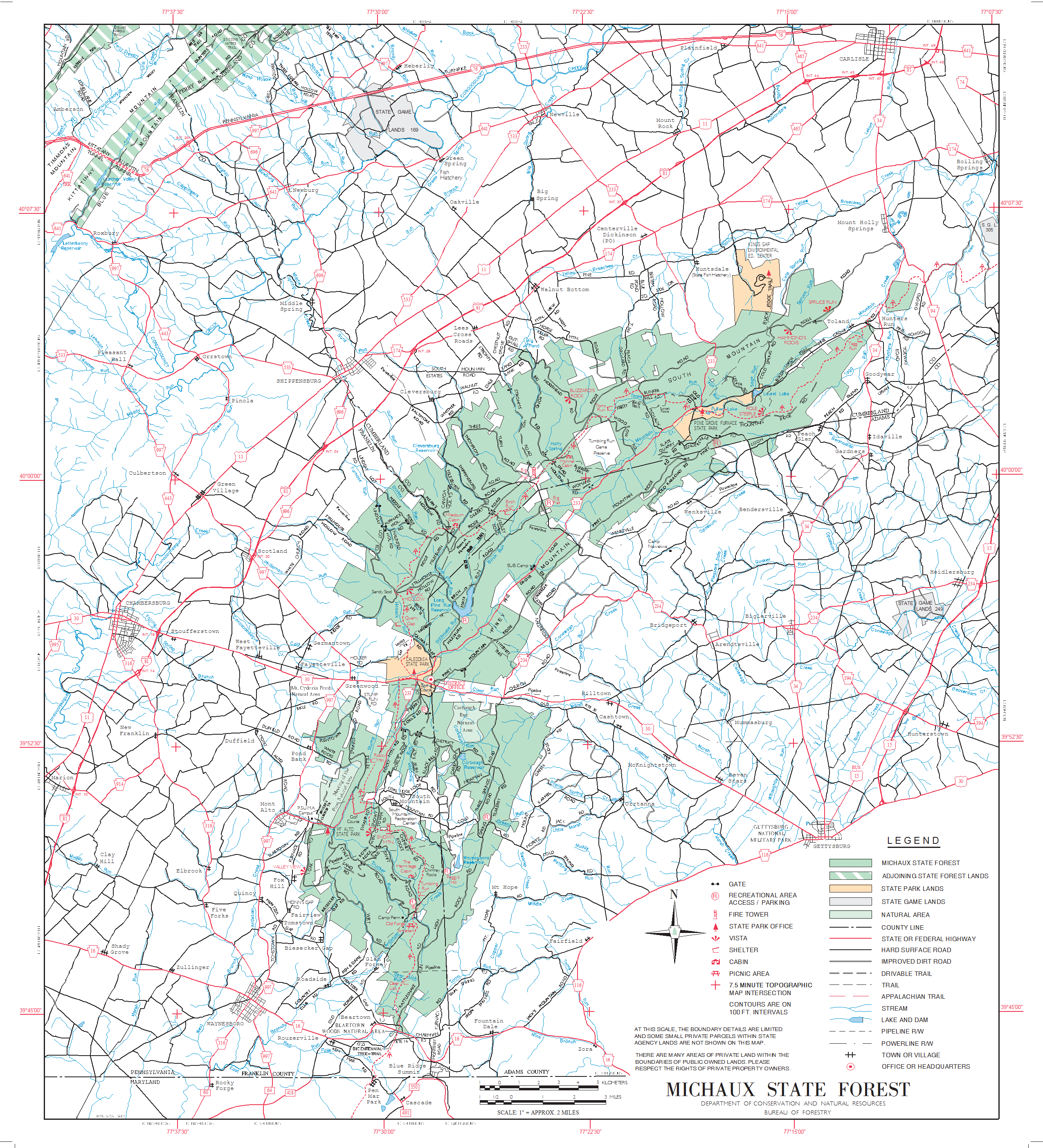
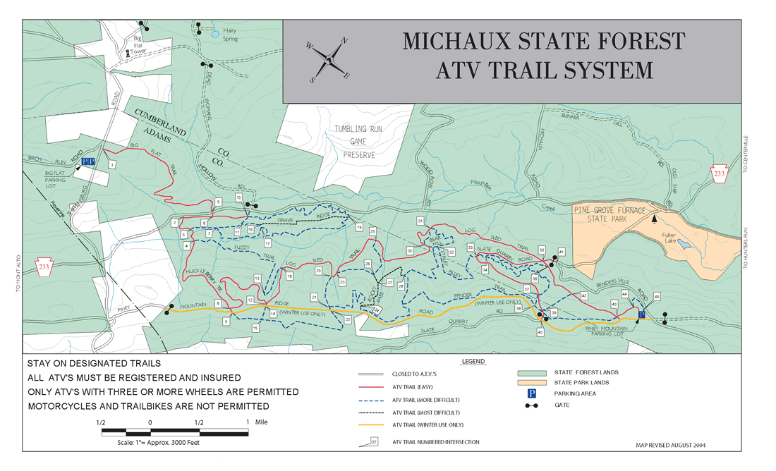
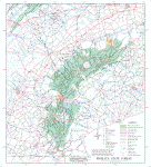
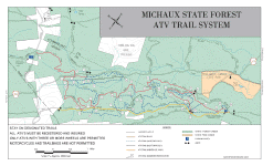
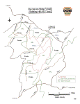
Michaux State Forest, PA
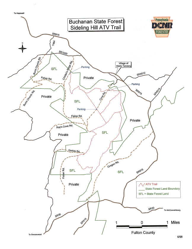
Buchanan
State Forest ATV Trail, PA
Not sure of the ability
to drive an SUV on these trails. I haven't found anything saying
we can't: http://www.dcnr.state.pa.us/forestry/atv/index.aspx